


Clochers de tourmente

pb07
User
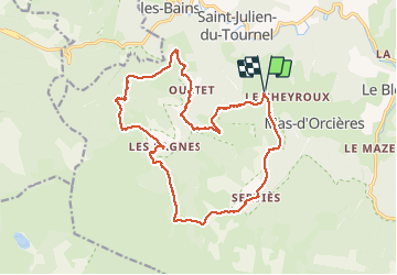

Length
19.2 km

Max alt
1361 m

Uphill gradient
613 m
Km-Effort
27 km

Min alt
1056 m

Downhill gradient
614 m
Boucle
Yes
Creation date :
2020-09-01 07:54:26.485
Updated on :
2020-09-01 14:39:45.218
6h08
Difficulty : Medium

FREE GPS app for hiking
 SityTrail
IGN / Geographical institutes
SityTrail Plus
The world is yours!
About
Trail Walking of 19.2 km to be discovered at Occitania, Lozère, Mont Lozère et Goulet. This trail is proposed by pb07.
Positioning
Country:
France
Region :
Occitania
Department/Province :
Lozère
Municipality :
Mont Lozère et Goulet
Location:
Mas-d'Orcières
Start:(Dec)
Start:(UTM)
555087 ; 4926086 (31T) N.
Comments
Merci, belle randonnée. Audier.